San Diego to Coldfoot

At some point, I don't remember when, I got the idea to ride my motorcycle to Cabo San Lucas, Mexico from my home in San Diego, California. I spent months inviting friends and changing plans to suit everyones needs. In the end, everyone decided not to go. So, in a bit of frustration I thought, "The hell with all of you, I'll just do an epic ride up to Alaska by myself!" I said this to myself a few times and the idea really stuck. So a month later I did just that. I rode from San Diego, California to Coldfoot, Alaska by myself.
Note: I would love to tell the story of this ride in amazing detail but unfortunately it has been to long to remember everything. For a long time this post was fairly generic with just a route and some pictures but a friend of mine has decided to do his own trip so I am now updating it with as much detail as I can remember.
Overview:
Bike: BMW R1200GSADistance: 5300+ miles (Estimated)
Time: 2 weeks in July of 2014
Sights:
Hwy 25
Lassen Volcanic National Park
Mt. Hood
Multnomah Falls
Bridge of the Gods
Banff and Jasper National Park
Signpost Forest
Denali National Park
Too much to list
Video:
Shipping the Bike:
It took me all of one day to realize I didn't have enough vacation time to make it a round trip. I only had 2 weeks vacation time I could spend on this trip. A round trip meant I would have to average 700 miles or more a day to make it home in time and that was just too much. So the first thing I did was book a flight back to San Diego from Fairbanks and arranged to have my BMW shipped to the local dealership close to my house. This way I could ride my BMW up to Fairbanks at a slower pace and then in a day be back at home. This was surprisingly easy to do in advanced. There is one big motorcycle dealership in Fairbanks. (It's actually two shops that have merged to make a massive one. Trail's End BMW and The Outpost. Two names and two shops but they have the same address and the same phone number.) Shipping bikes is something they do all the time. One phone call later and they sent me a quoted price of $1172.24 including motorcycle prep, crating and shipping. There was no money down, just an agreed upon date when I would drop off the bike and pay in person with a credit card.Heres a bike shipping tip: If you are storing anything on the bike in a pannier then make sure it is perfectly dry and preferably clean. Some of my camping and motorcycle gear wasn't so when it finally arrived in San Diego a month later the pannier was full of mold. My kneepads and gloves were ruined but the camping gear cleaned up after a while.
 |
| Shipping Quote from The Outpost. |
Note: The shipping quote from The Outpost was a bit off. They actually charged me $1187.24 when I dropped off the bike. $15 more than quotes. I guess my bike weighed a bit more than expected or something else had changed in the weeks before I arrived. Either way $15 wasn't a big deal.
Note: Here is the contact info for the motorcycle shop in Fairbanks.
The Outpost / Trail's End BMW
Address: 1450 Karen Way, Fairbanks, AK 99709
Hours:
Sunday Closed
Monday Closed
Tuesday 9AM–6PM
Wednesday 9AM–6PM
Thursday 9AM–6PM
Friday 9AM–6PM
Saturday 9AM–6PM
Phone: (907) 456-3265
General Advice for this Trip:
Crossing into Canada:
Anyone riding a motorcycle or driving a car into Canada has to have auto insurance that covers you in Canada. I was insured with Geico at the time and my regular policy had full coverage in Canada. In order to prove this at the border crossing I needed to have a special card from Geico saying I have coverage. All I did was call Geico and explain the situation. They knew exactly what I needed and mailed me the card free of charge within a week or two.I bought Canadian dollars at a bank in Oroville, Washington right before I crossed over into Canada. The official exchange rate was about 1 to 1 at the time and the bank offered a fair rate as well. Oroville is only about 4 miles south of the border so they have a good stock of Canadian dollars. If you don't exchange your money don't worry. Most places I stopped in Canada within 100miles of the border accepted United States Dollars without question and I just used my credit card for gas station fill ups. I would however suggest getting some Canadian dollars if you plan on going very far north. Many places in Northern British Columbia and the Yukon Territory are very remote, don't accept credit cards and only take Canadian cash.
Bugs:
Take a lot of bug spray and bring a extra mosquito net for the campsite or when you're relaxing in a hammock. I was eaten alive by bugs. The further north I went the worse it got. Having a huge windshield and multiple visors for my helmet was also a big help. The windshield got most of the bugs to keep my visor fairly clear. After a few hours of riding I would just switch the visors out and then clean both of them at night sitting in the tent. It saved time during the day and meant less time sitting outside getting eaten by bugs.
Ideas For a Future Trip:
Take "Top of the World Highway" between Whitehorse and Tok. (Hwy 2, Hwy 9 and Hwy 5) It seems more scenic and generally better than Highway 1.Bring a license plate to hang at the Signpost Forrest in Watson Lake.
Take the northern route (Hwy 97) from Jasper National Park to Watson Lake.
Take Denali Highway between Tok and Denali National Park if the highway is open. Ask around in Tok first.
The Route:
The hardest part about planning this trip was the route. I did a lot of research about road conditions and weather, I read dozens of ride reports on AdvRider.com and eventually settled on a general route. Below are three Google maps with notes about each section of the route.Note: In the end I really don't know the exact path I took. For the most part I would ride in a general direction, north, and take second use roads or dirt paths when I could. I have GPS on my BMW with a stack of paper maps as backup so I would just make up a route as I went not worried if I would get lost.
San Diego to Seattle:
(1481 Miles in 3.5 days. Averaging 423 Miles/Day.)
I had two intensions with this section of the route. Get through it quickly and minimize the time on Interstate 5. I rode this section in 3.5 days. I left San Diego after work on Thursday July 3rd and spent one night in San Luis Obispo at a friends house. (I'm very glad I did this because he gave me an amazing waterproof jacket and a sweatshirt. Two things I forgot to pack.) I then spent one day and night at my parents home in Stockton to celebrate the 4th of July. The next morning, Saturday the 5th, the real trip began.
I had two intensions with this section of the route. Get through it quickly and minimize the time on Interstate 5. I rode this section in 3.5 days. I left San Diego after work on Thursday July 3rd and spent one night in San Luis Obispo at a friends house. (I'm very glad I did this because he gave me an amazing waterproof jacket and a sweatshirt. Two things I forgot to pack.) I then spent one day and night at my parents home in Stockton to celebrate the 4th of July. The next morning, Saturday the 5th, the real trip began.
I rode from Stockton to Bend Oregon in one long day. I rode through Lassen National Forest and Klamath Falls Oregon. This meant no time on boring Interstate 5 and lots of time spent on old highways and going through small towns. I arrived at night and ended up sleeping next to my motorcycle in a very nice rest area north of Bend Oregon. (The Peter Scene Ogden State Park and Rest area off of Hwy 97.) I was nervous about sleeping there but nobody bothered me and it was quite nice and clean. I don't think its legal to setup a full campsite there but I recommend this spot as a good and free stealth campsite.
The following morning I rode to Multnimah Falls along the Oregon/Washington border. I hiked to the top of the 620' tall waterfall where there is a nice overlook looking straight down. After that I crossed "The Bridge of The Gods" into Washington and rode through the forest on various highways and second use roads until I was on the north side of Mt. Rainier. Unfortunately the saved Google map below doesn't show that last section through the mountains. For some reason it never wants to route through the mountains. I arrived at my friends house north of Seattle that evening and continued on the next morning after some well deserved rest in a bed. Little did I know it was the last night in a bed I would have until I reached Tok Alaska.
 |
| Slept the night at this rest area just north of Bend, Oregon. The Peter Scene Ogden State Park and Rest area off of Hwy 97. |
Seattle to Prince George:
(1373 Miles in about 5 days. Averaging 275 Miles/Day.)This middle section of the trip was by far my favorite. I spent a lot of time coming up with this route and I really slowed down my riding style to enjoy it. I started by headed north/east out of Seattle. I ate breakfast at a diner somewhere along the route and eventually crossed into Canada just north of Oroville. Crossing the border into Canada took an hour. They had a surprising amount of questions and looked over my bike too.
Once into Canada I went along a winding route up Hwy 33, 97 and 6. After a long day of riding I got to a ferry crossing. This ferry crossing was free and seemed to cross every hour or two. I had to wait a while but there is a nice rest area with a view there so waiting wasn't a problem. By the time I was across the river the sun was setting and I had to rush to make it to the Nakusp Hot Springs Campground before dark. I didn't make it in time. I ended up riding the winding Hot Springs Road in complete darkness but it was the most magical section of road I have ever been on. Maybe it was just fatigue getting to me but riding along that road at night with the icy rushing river nearby is something I'll always think fondly about. The campground was nothing special and by the time I arrived the hot springs were closed for the day. The office was also closed for the day so I ended up camping in a crowded grassy area full of other tents. The next morning I got up early and found the office was still closed so I left without paying. Oh well.
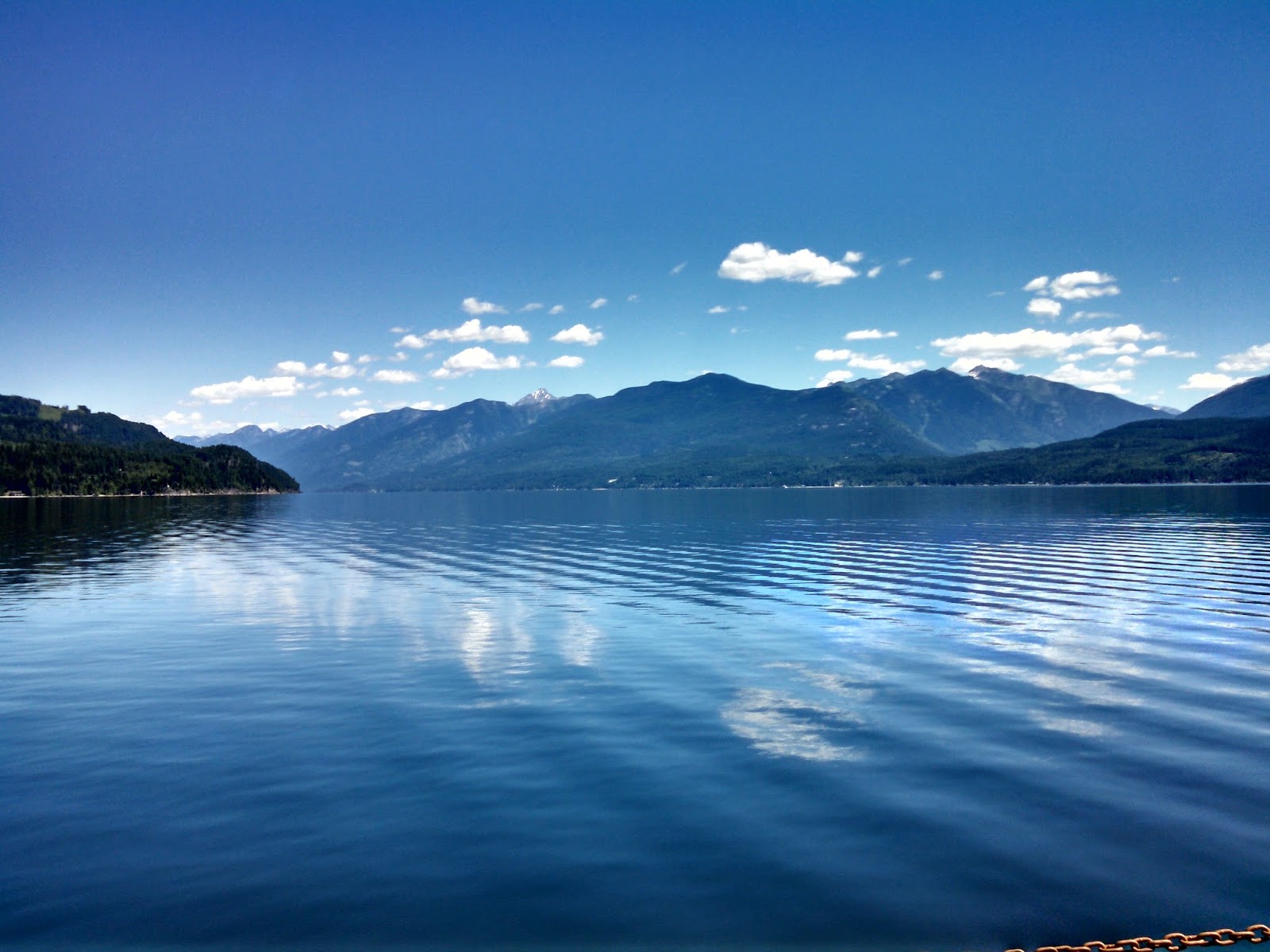
The following day I rode all the way to Banff by first heading south along Hwy 6 and Hwy 3, doing a second ferry crossing, riding south some more and then finally heading north along Hwy 95 right into the heard of the national park. Most of this ride was awesome but what really stood out was the second ferry crossing. On that particular clear day the water was so flat it was like a mirror. See the pictures below. I camped that night in Banff close to Castle Mountain which I hiked the next day.
 |
| View from the large second ferry crossing. Was an amazing clear calm day. |
 |
| Horseshoe Lake is perfect for cliff jumping. |
It was the section of road between Jasper and Prince George that I started noticing two things. The sun stopped setting completely at night and it was extremely cold during the day. The abundance of daylight was nice because I could go on long hikes in the evening and I hate riding back roads in the dark. The extreme cold was not so nice. I was wearing all the clothing I had with me and had my heated jacket and heated hand grips on full blast. I was still cold. I stopped at an outdoor store in Price George to buy insulated long underwear. Best purchase of the entire trip.
Then Prince George to Coldfoot:
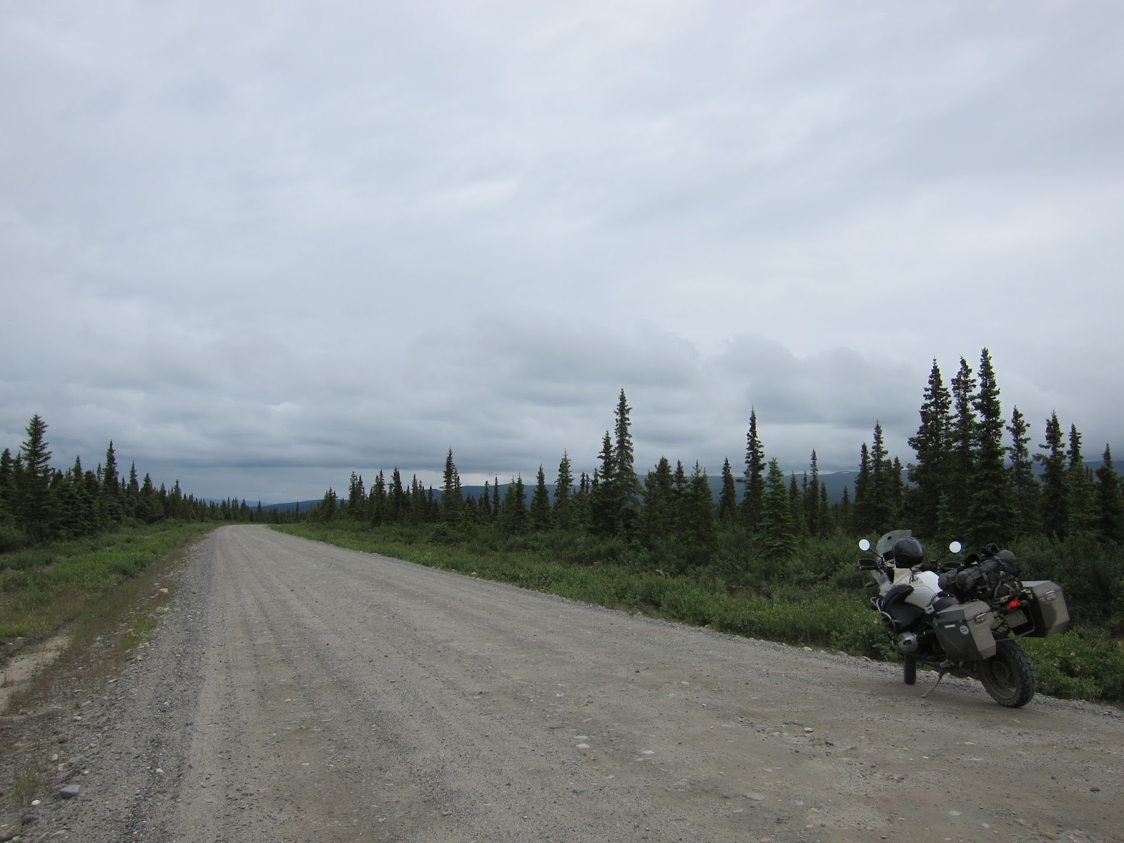
(2495+ Miles in 6 days. Averaging 415 Miles/Day.)Prince George to Watson Lake was scenic but fairly unspectacular. A few small towns along the way and I found a few dirt roads off the beaten path. The Mitten forest service road was a fun and fast paced ride but a bit too short. If you intend on riding this way be warned, there isn't much information about this stretch of road online. I did however find a hand drawn map at the Cassiar gas station. It has locations of other gas stations, campgrounds and lodges.
  | ||
Mitten forest service roadsigns for more info.
|

Watson Lake is one of the bigger towns in the area. It has some good sized general stores to stock up on supplies and a public library I used to send an email to my family. (I had no cel phone coverage in Canada and was traveling alone so I tried to check in with loved ones when I could.) Watson Lake is also home to The Signpost Forest. A small public rest area full of signs from around North America. Highway 1 between Watson Lake and Tok was also a nice ride. From what I remember it was a bit more scenic and had some very nice free campgrounds. Unfortunately I still had bad weather going through this section so I didn't see much.
Note: I think going the more northern route between Whitehorse and Tok is the way to go. From what I have heard Top of the World highway (Hwy 2, 9 and 5) is much nicer than Highway 1.
Once I reached Tok I finally booked a hotel for the night. It had been over a week of hiking, riding and not showering. I staid at The Golden Bear Motel right off of Hwy 1. Prices were fair, water was hot and thats all that mattered. The night I checked in they had a local guy doing a presentation about his dog sled team and all the races he has entered. That was cool to see. Before I left in the morning I did a quick cleaning of my bike. A fellow motorcycle rider in the room next door suggested it because the unsealed roads in the north leave a thin layer of abrasive mud on everything and it destroys the paint.
Just south of Tok along Highway 1 is the Matanuska glacier. It a land glacier that for a small fee you can go walk on. I went the cheapest route and just paid for access to the glacier. I think it cost $10. For a bit more you can rent spiked ice shoes and for a lot more you can book a guided tour. The tour looked fun but I would recommend the ice shoes. I spent about 2 hours walking on and around the glacier and fell quite a few times. One fall was fairly bad and I nearly slid down the slop and into the icy water. So, once again I recommend getting the ice shoes if you plan on walking on the glacier.
After a bit of hiking I camped just up the road in another beautiful camp site. The next day I headed south toward Anchorage but ended up avoiding the city altogether with just a quick stop in Palmer to stock up on supplies. Once I was all stocked up I headed north toward Denali National Park.
I started to ride on the Denali Highway but found out about 30 miles in that the road was closed. The recent rains had formed a rushing river and completely washed out the road. A bit disappointed, I turned around and went straight to Denali National Park and went on a long hike. It was pretty fortunate Denali Highway was closed because Denali National Park is amazing. The hike I went on had a breathtaking view at the top. This view is the closing credit scene at the end of my video. I do not remember the trail name but if I were to guess it was the Mt. Healy Overlook trail.
I hung around Denali National park for as long as I could and eventually headed up to Fairbanks. I was told by fellow traveler to stay at the Chena Hot Springs so I headed that way. My paper map showed it close to Fairbanks but its actually about 60 miles north east of the city. So, just like at Nakusp Hot Springs, I didn't arrive until late in the evening so I didn't get to relax much and I didn't get to enjoy the hot springs at all. Personally, I wouldn't go back to Chena Hot Springs. Its a bit too far off the path I wanted and was a bit too costly for me.
The following morning I headed back through Fairbanks and started along the Dalton Highway toward Coldfoot. My original goal was to go all the way north to Deadhorse but that didn't happen. As I arrive at Coldfoot and applied my rear brake one last time it decided to completely lock up and kill the engine. Not at all worried because I figured it was just a bit packed with mud I slowly got off the bike and pulled out my water bottle to take a drink. Thats when I noticed my rear brake was on fire. I guess it was so packed with mud it overheated and my last stop just made it all worse. I quickly poured my water bottle on the fire to put it out. Then I pushed my BMW the last hundred feet into the parking lot of Coldfoot's gas station/restaurant/bar. After a few hours of consideration I decided to drain my rear brake of fluid, completely separate the pads, tie up my brake pedal and then ride back to Fairbanks without a rear brake.
The remainder of the trip was fairly standard. Checked into a hotel. Slept for about 12 hours. Washed the bike and dropped it off. Then walked to the airport and flew home.
Note: I think going the more northern route between Whitehorse and Tok is the way to go. From what I have heard Top of the World highway (Hwy 2, 9 and 5) is much nicer than Highway 1.
 |
| Signpost forest panorama. |
Just south of Tok along Highway 1 is the Matanuska glacier. It a land glacier that for a small fee you can go walk on. I went the cheapest route and just paid for access to the glacier. I think it cost $10. For a bit more you can rent spiked ice shoes and for a lot more you can book a guided tour. The tour looked fun but I would recommend the ice shoes. I spent about 2 hours walking on and around the glacier and fell quite a few times. One fall was fairly bad and I nearly slid down the slop and into the icy water. So, once again I recommend getting the ice shoes if you plan on walking on the glacier.
 |
| Hiking on Matanuska Glacier. Watch your step! |
After a bit of hiking I camped just up the road in another beautiful camp site. The next day I headed south toward Anchorage but ended up avoiding the city altogether with just a quick stop in Palmer to stock up on supplies. Once I was all stocked up I headed north toward Denali National Park.
I started to ride on the Denali Highway but found out about 30 miles in that the road was closed. The recent rains had formed a rushing river and completely washed out the road. A bit disappointed, I turned around and went straight to Denali National Park and went on a long hike. It was pretty fortunate Denali Highway was closed because Denali National Park is amazing. The hike I went on had a breathtaking view at the top. This view is the closing credit scene at the end of my video. I do not remember the trail name but if I were to guess it was the Mt. Healy Overlook trail.
 |
| View from top of Mt. Healy Overlook Trail. |
The following morning I headed back through Fairbanks and started along the Dalton Highway toward Coldfoot. My original goal was to go all the way north to Deadhorse but that didn't happen. As I arrive at Coldfoot and applied my rear brake one last time it decided to completely lock up and kill the engine. Not at all worried because I figured it was just a bit packed with mud I slowly got off the bike and pulled out my water bottle to take a drink. Thats when I noticed my rear brake was on fire. I guess it was so packed with mud it overheated and my last stop just made it all worse. I quickly poured my water bottle on the fire to put it out. Then I pushed my BMW the last hundred feet into the parking lot of Coldfoot's gas station/restaurant/bar. After a few hours of consideration I decided to drain my rear brake of fluid, completely separate the pads, tie up my brake pedal and then ride back to Fairbanks without a rear brake.
The remainder of the trip was fairly standard. Checked into a hotel. Slept for about 12 hours. Washed the bike and dropped it off. Then walked to the airport and flew home.
 |
| Rear brake problems so spread the brake pads and tied off the pedal. The reason I didn't go further north than Coldfoot. Rode back to Fairbanks without a rear brake. |
 |
| Coldfoot Alaska. Small town. |
Here are more pics:
Enjoy! |
| Selfie while riding. |
 |
| Lassen National Park. |
|
| Slept the night at this rest area just north of Bend, Oregon. The Peter Scene Ogden State Park and Rest area off of Hwy 97. |
 |
| View from top of Multnomah Falls looking down the 620' waterfall. I stood their for an hour waiting for that log to fall. It moved a lot but didn't go over the edge. |

 |
| My setup. Easy access to camera, GPS navigation and a simple handlebar bag. |
 |
| Large ferry crossing to Kootenay Bay, BC. |
|
| View from the large second ferry crossing. Was an amazing clear calm day. |
 |
| More of the same view. |
 |
| Even more of the same view. |
 |
| Best gas station bought camping dinner. Campbell's tomato soup with mixed in canned green beens and a box of Triscuits. At least it was warm. |
 |
| Typical camping breakfast of instant oatmeal with brown sugar. While listening to an audiobook. |
 |
| Rockbound Lake hike in Banff National Park. |

 |
| Halfway up to Rockbound Lake. |

 |
| Rockbound Lake Jasper National Park. |


 |
| This is my happy place I think about while working or washing dishes at home. Camping hammocks are perfect for motorcycle travel and are best setup nearby lakes with a view. |
 |
| More relaxing in the hammock. |
 |
| "Small" forest fire on my way out of Banff. |
 |
| Viewpoint with glass floor in Jasper National Park. |
 |
| The glass floor of this viewpoint wasn't very transparent. |
 |
| Horseshoe Lake in Jasper National Park. |
|
| Horseshoe Lake is perfect for cliff jumping. |
 |
| More Horseshoe Lake. The water was freezing cold, blue and clear. |
 |
| Hiking around Horseshoe Lake after going for a swim. Very stylish. |
 |
| Even more Horseshoe lake atop a 40ish foot tall cliff. I didn't jump. |
 |
| Small dirt forest service road. |
 |
| Sunset somewhere in the Yukon. |
 |
| A handy map at one of the gas stations. Shows camp sites and gas stations. |
 |
| One of my roadside campsites. |
 |
| Many, many mosquitos. |
 |
| Signpost forest. |
|
| Signpost forest panorama. |
 |
| Mama and cub black bears. The entire highway was blocked with stopped vehicles taking pictures of these guys so I did too. |


 |
| Met a guy towing and driving this across North America. Its semi-modernized with inflatable rubber wheels and a 300cc Honda motorcycle engine. |
 |
| The view from my tent most mornings. |
 |
| Somewhere in Alaska between Tok and Palmer. |
 |
| Somewhere in Alaska between Tok and Palmer. |
 |
| Matanuska Glacier. |
 |
| View of Matanuska Glacier from the parking lot after you pay your entrance fee. |
 |
| Section of Denali Highway I did get to ride. |
|
| View from top of Mt. Healy Overlook Trail. |
 |
| Abrasive mud build up on the bike. Im glad I bought knobby tires. |
 |
| View from Dalton Highway. |
 |
| Met many other bikers along the way but only have one picture. Native Alaskan on his way to the arctic ocean riding a KLR650. |
|
| Rear brake problems so spread the brake pads and tied off the pedal. The reason I didn't go further north than Coldfoot. Rode back to Fairbanks without a rear brake. |
|
| Coldfoot Alaska. Small town. |
 |
| BMW clean and reading for shipping back to San Diego. |


Comments
Post a Comment
Write a comment here. Let me know what you think...